Learning on Longonot
17th March 2019
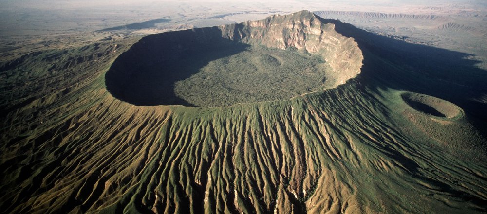
Last Thursday the seismometers set up around Mount Longonot National Park would have certainly detected a rise in vibrations. Thankfully the source of these disturbances was not the re-awakening of the slumbering magma chamber and forthcoming pyroclastic flows – but they in fact came from 60 Year 7 students from Braeburn setting out to conduct their geographical fieldwork studies.
Mount Longonot, sitting at the heart of the Great Rift Valley presented a fantastic environment for our students to utilise the skills and knowledge have been building up over the course of the year in a dynamic, real-world setting. Work was focused around 3 key learning areas – What type of volcano is Mount Longonot?, how sustainable are National Parks in their current state? It also allowed the students to get practical experience using their mapping and orientation skills.
Annotated field sketches were delicately put together, samples of lava and ash for historic eruptions were taken, environmental quality surveys were conducted, and maps were drawn up of the National Park. All of the student’s efforts paid off, and a great array of primary data was collected so that a more thorough analysis can now be undertaken in the classroom.
Alongside all of this, the students must be commended for the endurance and determination they showed in reaching the towering summit of the volcano, especially considering the thin air found at altitude and the clouds of dust that seemed to enshroud them at every step. Many of them took home a great sense of pride in achieving this feat, and all certainly gained from the experience of looking at this wonderful, tectonically active environment in a new inquisitive, learned, and geographically aware way.
Finally, a huge thanks must go out to the teachers who gave up their time to accompany the students in their fieldwork study, and to the support from the Year 7 parents who made the trip possible.
Mr Zammit, Geography Teacher